
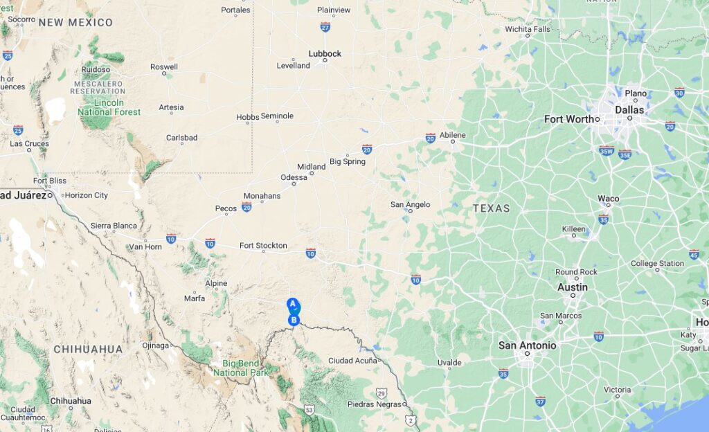
After our 3 months in Kerrville, Texas, (Last Post) we headed to Virgin/St George, Utah, (just outside of Zion National Park). We planned to be there for a couple months before heading north to Montana for the summer. When we left Texas in mid-February we decided to travel the Southern route and visit Big Bend National Park. Big Bend had been on my list for a while. And then my parents pointed out that Big Bend is very close to some land they owned, which we affectionately call “the Christopher Land”. Since I had been curious about this land, I decided it was high time to visit.
The Story
My Great Grandfather (George Christopher) worked for Shell Oil back around the turn of the century. One year Shell Oil bonused their employees by giving each one a 40 acre piece of railroad land in Texas. Subsequently it had passed to my Grandfather, Edgar Christopher, and finally my mother Barbara Christopher Swenson. But none of the owners had ever to this day stepped foot on the land, much less seen it. A few years back (20?, 30?) my parents had made an attempt. But this was pre-Google Earth, pre-GPS, and they were in a low clearance Toyota Supra. That car, frankly, could not have made the journey.
But where is it?
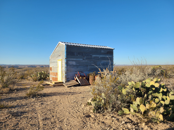
The visit to the Christopher parcel of land was not as easy as it might sound. First we knew very little about it. I knew the county we thought it was in, and with their help I tried to locate the property. They could not send me the deed, something about paying them $1 a page up front or something. Anyway, I failed at that but did a lot of research online and ended up drawing this assumed location. But I could tell, something was not right.. It really appeared the parcel was in the wrong county. The best news was it looked like there was a road on the map going straight to the land, AND a small storage building as a marker for the corner. What luck!!.
The Christopher land is at “B”.

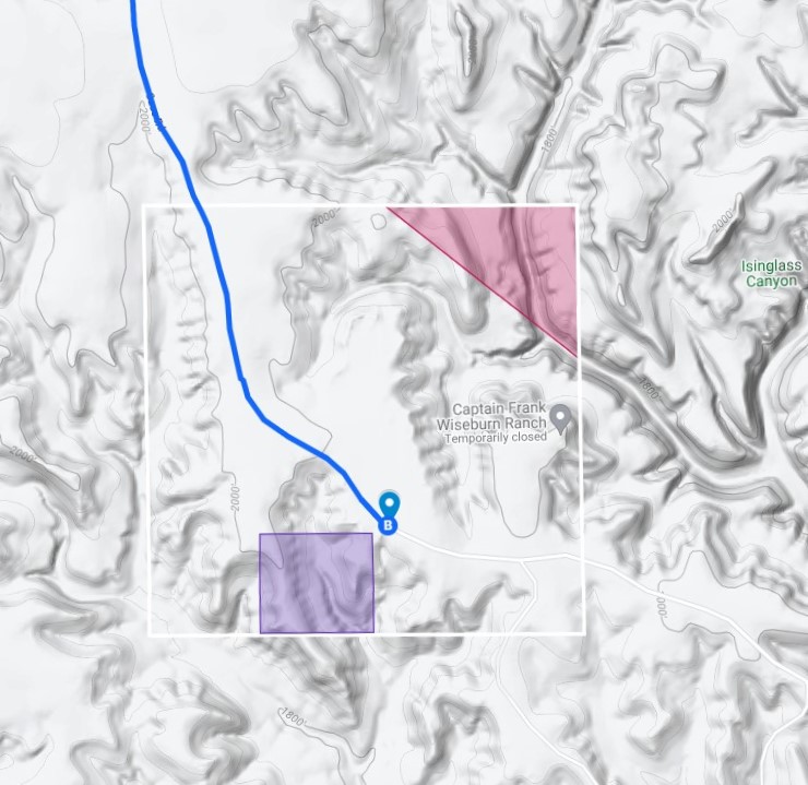
But note the road that goes right to the corner of the property, and coincidentally a shed on the road to mark the spot!
THIS was huge. It could have been miles from the nearest road! As it was the road went to it. My parent had determined this much at the assessor’s office in Sanderson Texas. They had started down the same road, but it was a 4-wheel drive road at best. They did not get to far.
A visit to the County Seat
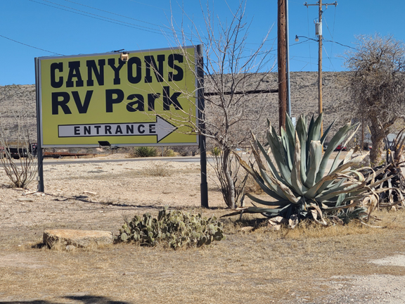
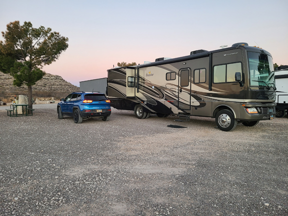
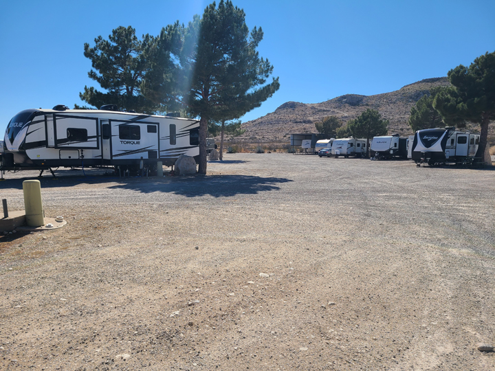
I called the county seat of the other county and they had no records for any Christopher deed’s at all. So without further information we headed out to Sanderson, Texas, the Terrell county seat. We stayed in a little on-your-honor RV park. This town presumably had once been thriving, but now there was nothing left of it. The county business was still here, but there is not a restaurant, or anything else in Sanderson. There was perhaps a gas station! The nearest grocery store to town was 60 miles away. But the RV park was surprisingly pleasant.
And the County Assessor’s office
After getting settled just afternoon, we went to the county assessor’s office. Here I could pay for each page and help her trace the documents down. I found my grandfather’s will where the land had be left to my Mother. I found the document where the land was sold to my Grandfather from his father for the sum of $10. And I found the deed that my Great-grandfather, George Christopher, had been given in 1914… Wow.. 100 years of history in those papers. There was a problem though. The problem I noted when I tried to plot it from Kerrville. The legal description listed it in the wrong county!
The Assessor did not really know what to do. She sent me to chat with a guy, the chief appraiser, Blain Chriesman.. He had all the plat maps. The assessor’s office pointed out that he has been here forever and knows everything! So we traipsed ever to his office. I sat down to tell my story. The further I got, the more interested he became until he couldn’t keep himself in the seat anymore! He leapt up to go find some plat maps. Blain suggested that the county lines were not very distinct back then, and that it probably was recorded in the wrong county. We probably spent an hour and a half with him helping me solve this mystery.
Back Taxes
Blain asked for an updated address for my parents since they had lost track of them 6 years ago. There were back taxes due. So I got that cleaned up. After which he handed me a bill for 6 years worth of back taxes, totaling $89. (My mother likes to point out that she thought the IRS would catch up with them sooner or later, but she never thought it would be her own daughter to turn her in!)
And finally to the Christopher Land
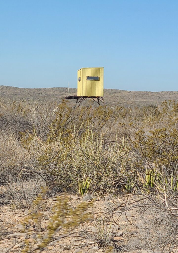
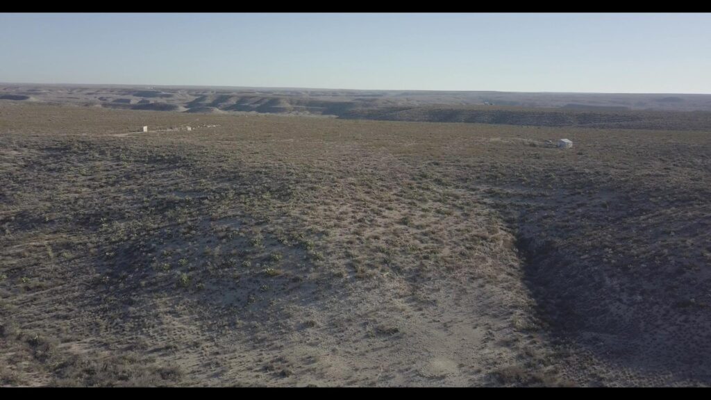
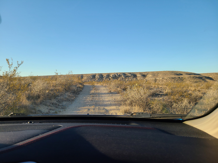
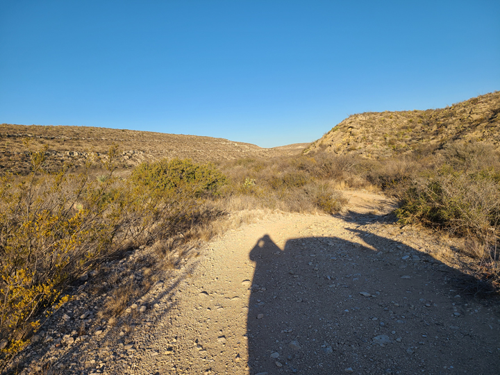
The next morning we headed out early to see if we could find the land. The road took us 30 miles off pavement. We traversed stream beds and passed LOTS of hunting blinds. Finally the “road” was a two track overgrown with weeds. Thankfully we didn’t attempt to bring to RV to stay on the land!
The nearest electricity was at a house that looked semi-lived in 4 miles away. Although Solar would be perfect out here.
Mexico was 3 miles as the crow flies and we could see the canyon where the Rio Grande flows. I tried to fly the drone out to take a look, but it was too hard to keep my bearings. Plus, although the specs say I can fly the drone 5 miles away… It’s still REALLY SCARY! Blain had told us a well in these parts might be 900 feet deep! The nearest grocery store is 90 miles away.. 30 miles of which is dirt road.

The future of the Christopher Land?
The contour of the land, makes it an interesting parcel… But the logistics made it quite impossible to develop and too remote to be of interest. The only reason the road comes out this far is that there is a hunting ranch adjacent to the property. 30 yards on down the road is a gate for the ranch. Once I got the address corrected, the ranch wasted no time making an offer to buy the land.
The offer came to about $100 an acre, which matched what the assessor’s office told us it appraised for. The assessor also told up before we could use the land we would have to have it surveyed. The deed would need to be corrected for the correct county which would cost more than the land was worth. The offer proposed to cover the cost of the survey and correction of the deed. My parents counter offer was accepted, and they closed a month later.
Yeah… So, I’m super glad we got to visit the Christopher land, and truly it was a fun adventure. The Christopher land is now in the history books, or at least commemorated in this blog. But even if it no longer exists in the physical world, it’s a true story with a 100 year legacy.


Thanks for the backstory and sharing the photos and drone footage. Hope you guys are hunkered down for the oncoming winter.
Good to hear from you Steve. We came through Vegas last week with to little time to be social. We are settled in Mesa for the Winter. Still pretty warm, but hoping to do a lot of inspection work over the winter.
What a fun story! Best wishes to you and your parents.
Thanks, Jackie.. Hope you are well!
I really enjoyed reading your story. It was an amazing bit of history.
Sounds like all is well with you.
Hey Dan.. Looks like we will be in Heber City, Utah for the summer 2023. Will we see you there?